|
Custom illustrated maps are a great investment for yourself, company or organisation as they can be adapted in different ways and used on promotional material and more for years to come. As I design them digitally as vectors, once the initial eye-catching design is created it can be updated with more relevant details if and when required. The individual details in the map can also be taken out and used for other purposes (say, if I highlight a particular building or historic moment, it can then be used for letterheads, online, as cards and more). One example of this is the multiple ways in which I’ve repurposed this map design of Clevedon in North Somerset, England. The original map was commissioned by Discover Clevedon to be placed on boards throughout the town to inform locals and tourists of shopping areas, tourist attractions and other key amenities in a visually appealing way. It also sought to link the different areas of the town together. 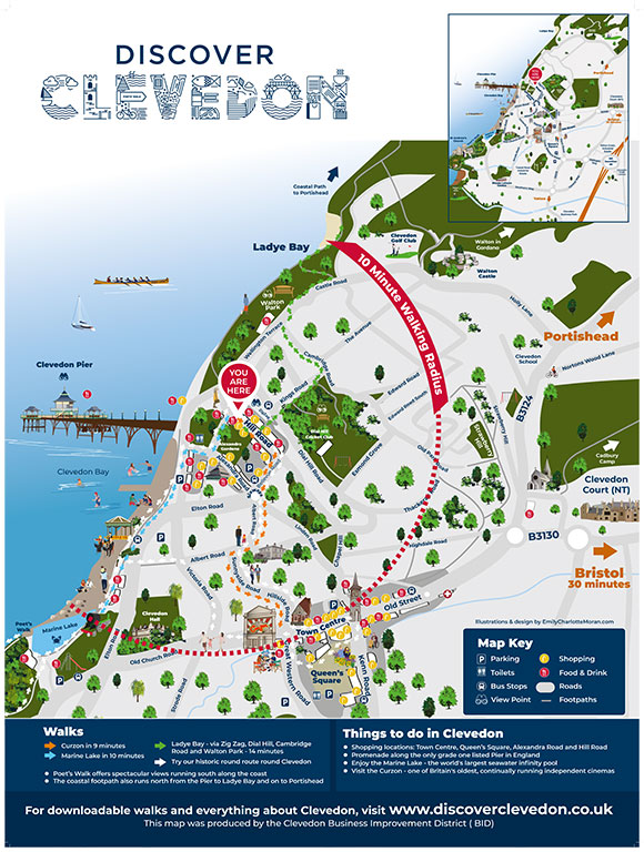 Illustrated map design by Emily Charlotte Moran. The maps were initially included on thousands of Discover Clevedon leaflets (which I also designed) that were distributed across the region, on map boards that were installed throughout the town and on informational boards that I also designed (featuring details of town’s history, geology and more) which are also in prominent places throughout the area. 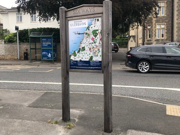 The illustrated map displayed on a board in Clevedon, North Somerset. Since that first design was created, I've adapted it for Clevedon Literary Festival and Clevedon Library. Clevedon Town Football Club also asked me to rework the map for an information board (which I also designed) that now takes pride of place outside the Seasiders' Everyone Active Stadium next to its new Heritage street art mural. 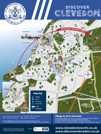 Bespoke map illustration for Clevedon Town Football Club. 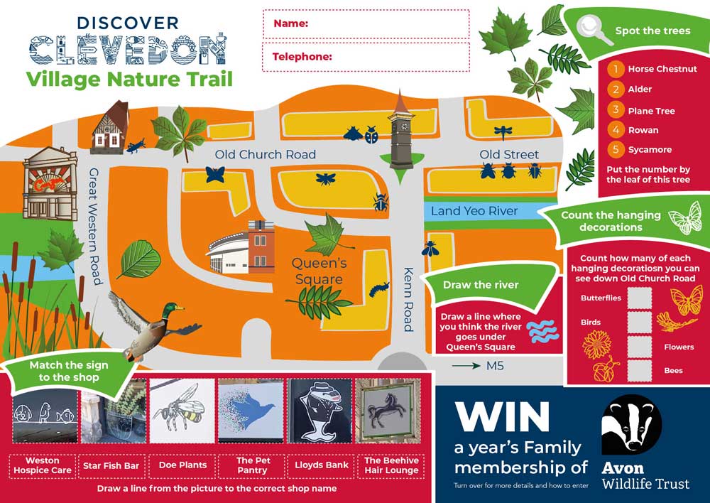 Educational materials design, seamlessly blending illustrations and graphic design. I've adapted the map to highlight several walking routes in Clevedon. The Clevedon Walks page on the Discover Clevedon website, where they feature, is its most popular: 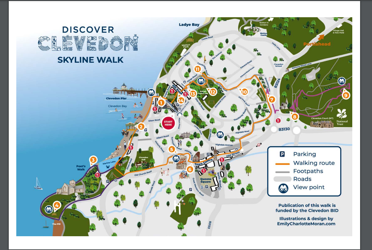 The Clevedon Walks page on the Discover Clevedon website is one of its most visited pages. I have also updated the map for a brochure to promote “The Hamptons” apartment development in the town. For this job, I was also commissioned to add in other relevant locations, including a bespoke illustration of the beautiful, historic building itself. See how my design blended seamlessly into the rest of the brochure here (on page 13): 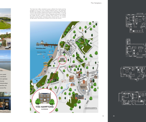 The illustrated map adapted for inclusion in the promotional brochure for "The Hamptons" development in Clevedon. As I explain in further detail on my custom map-making services page, my informative and fun maps can be created to cover a wide variety of places and events — from a personal gift or memento of a special occasion or moment to explaining places like heritage sites and museums, nature reserves, a directory of shops and restaurants, a navigational tool for university students on campuses, an educational tool for children, explaining retail parks, detailing music and sport festivals, family trails, walking routes and much more.
The maps can be as minimalist or as detailed as you like. Want to include some quirky details? Or do you just need them as a black and white map outline to form part of a book? No problem! And because I design them as vectors, they can be scaled up to billboard-size with no loss of quality. I can also adapt them to look great on social media platforms (such as Instagram, Facebook, X, Threads, LinkedIn, TikTok), for use on websites or as physical boards, in leaflets and brochures or books. Do you need a map illustrator for your project? Get in touch here.
0 Comments
|
I'm an illustrator, freelance graphic designer and artist with nearly 20 years experience of working on eye-catching tourism campaigns, multi-million pound bids, illustrated maps, company branding, personalised illustrations and more. Archives
March 2024
Categories
All
|
 RSS Feed
I would love to hear from you
TelephoneMobile: +44 (0) 7540236713
Office: +44 (0) 117 318 5499 Working hours - Monday to Friday 8am - 5pm
|
|
|
Copyright © 2013-2024 Emily Charlotte Moran. All rights reserved.